Self-guided itinerary · free
Kaçkar hiking itinerary: 3 days in Yaylalar, Olgunlar and Dilber Düzü
Enter the Kaçkar Mountains from the south, via Yusufeli in Artvin: warm up on day one with a walk from Yaylalar to Olgunlar, on day two climb with a guide to Dilber Düzü below the summit and back, and on the last morning walk down the valley and head home.
Prepared by: Kolay Seyahat content teamLast updated 23/10/2026Every fact links to an official source

This is not a package tour. This itinerary is free information. Flights, hotels and experiences are each sold separately, under their own seller’s terms, with separate payment and a separate contract. Prices are never linked to one another.
For this trip
Day by day
Progress is saved on this device only. Your location is never sent.
Itinerary map
Follow the stops day by day on the map; stops you mark as done turn green.
Map tiles come from OpenStreetMap servers. Your location is never read or sent anywhere; progress stays on this device.
A day route appears on days with at least two stops at a verified location; on other days you can open each stop in Google Maps.
Stops without a map location (6)
These stops have no verified location yet, so they are not placed at a guessed spot. Google Maps searches them by name.
- Day 1 · 1 YusufeliOpen in Google Maps
- Day 1 · 3 Warm-up walk from Yaylalar to OlgunlarOpen in Google Maps
- Day 2 · 1 The climb from Olgunlar to Dilber DüzüOpen in Google Maps
- Day 2 · 3 Back down the valley to OlgunlarOpen in Google Maps
- Day 3 · 1 The Olgunlar–Yaylalar valley roadOpen in Google Maps
- Day 3 · 2 Back to the airport via YusufeliOpen in Google Maps
Day 1 · From Yusufeli to Yaylalar, then on foot to Olgunlar
Reach Yusufeli before noon, take the mountain road up to Hevek (Yaylalar) village and end the day with a 3 km walk to Olgunlar, where the Dilber Düzü walk starts, to get your legs ready for the next day.
Day 1 · 1 · 11:00–12:00
Yusufeli
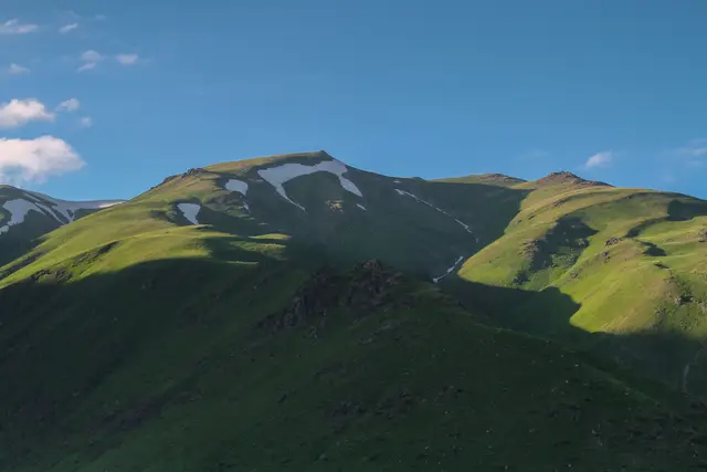
The road to the southern face of the Kaçkars starts in Yusufeli, a district of Artvin. The Ministry of Culture and Tourism’s Kültür Portalı says a guide and pack animals can be found in Yusufeli or in the villages along the road, so a short stop here is worth it not only for lunch but also to find the person you will plan the mountain day with. Agree with your guide on the start time for day two, what you will do if fog comes in, and the way back. Before heading up, stock up here on food for the mountain, spare batteries and first-aid supplies.
Getting there
Rize-Artvin Airport is 34 km from Rize city centre and 125 km from Artvin city centre; it is served by the HAVAŞ shuttle, minibuses, taxis, hire cars and private cars.
Source: dhmi.gov.tr · last checked 2026-10-23
Good to know
A guide and animals to carry gear can be found in Yusufeli district or in the villages along the road.
Source: kulturportali.gov.tr · last checked 2026-10-23
Tips
Before you set off, ask your accommodation or a local source about the current state of the Yusufeli–Yaylalar road.
Day 1 · 2 · 12:30–14:30
Hevek (Yaylalar) village
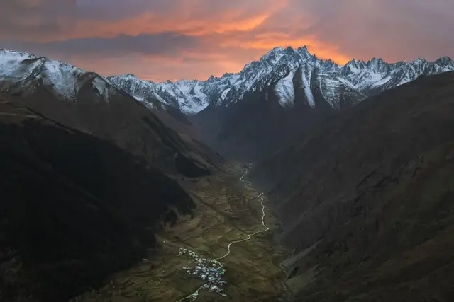
The mountain road out of Yusufeli climbs to Hevek, known today as Yaylalar. Kültür Portalı gives the distance as 57 km, while the transport line on the same page says 60 km, so expect a longer drive on a mountain road rather than a quick hop. Yaylalar is the stopover for people who want to climb the Kaçkars, and the place where walkers heading for the mountain continue on. Get out of the car here and check your boots and pack one last time before you start walking.
Getting there
From Yusufeli it is 57 km by road to Hevek (Yaylalar) village and 3 km from the village to Olgunlar; Dilber Düzü is reached on foot from Olgunlar.
Source: kulturportali.gov.tr · last checked 2026-10-23
Good to know
Yaylalar village serves as the stopover for those who want to climb the Kaçkar Mountains.
Source: kulturportali.gov.tr · last checked 2026-10-23
Tips
This itinerary spends both nights in Olgunlar; there are very few places to stay there, so book before you set off.
Day 1 · 3 · 15:00–16:30
Warm-up walk from Yaylalar to Olgunlar
The day’s only walk is short but matters: the 3 km village road from Yaylalar to Olgunlar gets your body used to the altitude before the next day’s long climb. Take it slowly and allow an hour to an hour and a half. According to Kültür Portalı, Dilber Düzü is reached on foot from Olgunlar, so the next day’s path starts here. Taking a look at the start of the path in the late afternoon means you will not be searching for it in the dark the next morning.
Getting there
- Walk
Good to know
It is 3 km from Hevek (Yaylalar) village to Olgunlar; from there you continue on foot to Dilber Düzü.
Source: kulturportali.gov.tr · last checked 2026-10-23
Tips
Go to bed early: setting off around 06:30 on day two buys you time against fog that can come in during the afternoon.


Day 2 · From Olgunlar to Dilber Düzü and back
Leave Olgunlar at first light, walk up to the Dilber Düzü campsite below the Kaçkar summit, and after a lunch stop return to the valley on the same path.
Day 2 · 1 · 06:30–11:30
The climb from Olgunlar to Dilber Düzü
This is the longest and hardest day of the itinerary. According to OpenStreetMap records the path is about 7.4 km one way and its last section is marked as demanding mountain hiking; official sources give no climbing figure, so none is given here either, but you will feel your steps shorten as you gain height. Kültür Portalı advises every group to take a guide, because fog can come in suddenly, the weather can change and walkers can lose their way on the path. Keep to your guide’s pace, take a short break every hour and drink before you feel thirsty.
Getting there
- Walk
Good to know
Every group and visitor wishing to explore the Kaçkar Mountains is advised to take a guide; sudden fog, weather conditions and losing the path are among the risks.
Source: kulturportali.gov.tr · last checked 2026-10-23
Tips
Leave by 06:30 at the latest because of the risk of afternoon fog; if the weather turns, stop and come back the way you went up.
Day 2 · 2 · 11:30–12:30
Dilber Düzü
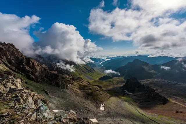
Dilber Düzü is the campsite closest to the Kaçkar summit. There are no facilities, but there is plenty of cold water, so you can refill your bottles. The route to the summit continues from here past the lake called Deniz Gölü. Kültür Portalı says climbing beyond Dilber Düzü without a guide is dangerous; this itinerary does not include the summit or Deniz Gölü and turns back at Dilber Düzü. Do not stretch the break: wind and cloud can arrive quickly, and you need daylight and energy for the descent.
Good to know
Dilber Düzü is the campsite closest to the Kaçkar summit; it has plenty of cold water and no facilities.
Source: kulturportali.gov.tr · last checked 2026-10-23
Good to know
Climbing the Kaçkar Mountain beyond Dilber Düzü without a guide is dangerous; the summit route passes Deniz Gölü.
Source: kulturportali.gov.tr · last checked 2026-10-23
Tips
Treat or boil spring water before drinking it, and carry your rubbish back down.
Day 2 · 3 · 12:30–17:00
Back down the valley to Olgunlar
The descent is quicker than the climb but harder on the knees. Follow the same path down and, when tired, focus on placing each step securely rather than on speed. Lynx, bears, wild goats, wolves, jackals and foxes live in the area; watch animals from a distance and leave no food behind; if you come across a flock, keep away from the sheepdogs. Once back in Olgunlar, call it an early night: the next morning brings only a short walk but a long drive.
Getting there
- Walk
Good to know
Wildlife such as lynx, bear, wild goat, wolf, jackal and fox can be seen and photographed in the area.
Source: kulturportali.gov.tr · last checked 2026-10-23
Tips
If you are tired, trekking poles make the descent easier on your knees.

Day 3 · Walk from Olgunlar to Yaylalar and head home
Walk down the valley to Yaylalar in the morning, then return to the airport via Yusufeli.
Day 3 · 1 · 08:00–09:30
The Olgunlar–Yaylalar valley road
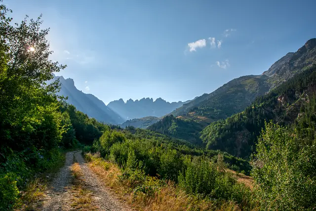
On the last morning you walk the road you took uphill on day one, this time downhill and on rested legs. Artvin’s Provincial Directorate of Culture and Tourism says the Kaçkar range divides into three massifs from west to east: Verçenik in the west, Kavran in the middle and Altıparmak in the east. The mountains’ rugged look, made of granite, syenite, granodiorite and andesite, was shaped by rivers and glaciers wearing them down.
Getting there
- Walk
Good to know
The Kaçkar Mountains run in three sections from west to east: Verçenik in the west, Kavran in the middle and Altıparmak in the east; the mountains are mostly granite, syenite, granodiorite and andesite.
Source: artvin.ktb.gov.tr · last checked 2026-10-23
Tips
If bags can be sent ahead by pack animal or vehicle, send the heavy pack on and walk light.
Day 3 · 2 · 10:00–14:00
Back to the airport via Yusufeli
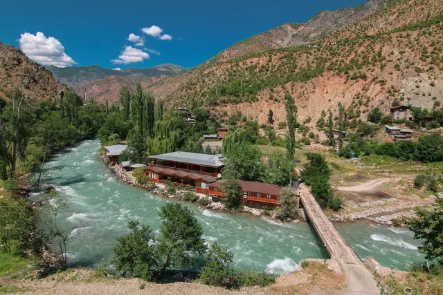
The road down from Yaylalar to Yusufeli is the mountain road you came up on day one; take your time and slow down on bends and through villages. In Yusufeli you can ask at local restaurants for puçuko, a dish from Artvin registered with a geographical indication. If you are flying from Rize-Artvin Airport, bear in mind that Artvin city centre is 125 km from the airport; Erzurum Airport is 13 km from its city centre. If you are flying on the day you come off the mountain, leave a wide margin.
Getting there
Erzurum Airport is 13 km from the city centre; it is served by Erzurum Metropolitan Municipality buses, taxis, hire cars and private cars.
Source: dhmi.gov.tr · last checked 2026-10-23
Tips
Use a hire car or a transfer arranged in advance for the return; official sources give no public transport times within the area.


Getting around
Entrance fee
In the 2026 tariff, Kaçkar Mountains National Park is in category I of the Black Sea-2 group in Artvin and Rize; the category I entry fee per person in this group is TRY 65.
Source: tarimorman.gov.tr · last checked 2026-10-23
Entrance fee
Anyone found to have entered a national park without paying the entry fee is fined four times the fee (law of 19 March 2026).
Source: tarimorman.gov.tr · last checked 2026-10-23
Good to know
Kaçkar Mountains National Park covers 52,970 ha, 35% (18,013 ha) of it forest; most of it lies in Rize’s Çamlıhemşin district, with parts within the provincial borders of Erzurum and Artvin.
Source: bolge12.tarimorman.gov.tr · last checked 2026-10-23
Good to know
The Kaçkar Mountains are the only place in Türkiye where rhododendrons reach 3,000 metres; 2,500 plant taxa have been recorded, about 300 of them endemic to Türkiye.
Source: bolge12.tarimorman.gov.tr · last checked 2026-10-23
Good to know
The Kaçkar Mountains have glacial lakes, glacial valleys, cirques and moraines; they are one of the rare places where Pleistocene glacial traces and present-day glaciation are seen together.
Source: bolge12.tarimorman.gov.tr · last checked 2026-10-23
Good to know
The Kaçkar Mountains were declared a national park in 1994; the park has 8 walking trails, 9 villages and 33 highland settlements.
Source: kulturportali.gov.tr · last checked 2026-10-23
Good to know
In winter, snow fills the valleys and covers the highland pastures, and the slope of the glaciers favours avalanches. August and September are the most suitable time for summer climbs.
Source: artvin.ktb.gov.tr · last checked 2026-10-23
Good to know
As winter approaches, snow can close valleys and cover the highlands and walking trails; this white cover lasts until the beginning of summer.
Source: goturkiye.com · last checked 2026-10-23
Good to know
In national parks, noisy activities that disturb the environment or other visitors and loud music are not allowed; visitors use these areas within the rules set by the park administration.
Source: tarimorman.gov.tr · last checked 2026-10-23
Good to know
All emergency numbers have been merged into 112; calls to 112 from mobile and landlines are free and the caller’s location is detected automatically.
Source: icisleri.gov.tr · last checked 2026-10-23
What and where to eat
Local specialities
Puçuko
Registered with an indication of source on behalf of the Artvin Chamber of Commerce and Industry (registered 26 December 2017, dishes and soups group); ask for it at local restaurants in Yusufeli and Artvin.
Source: TÜRKPATENT Coğrafi İşaret · Geographical indication (reg. no 303) · last checked 2026-10-23
Opening hours and prices vary by venue; check the venue’s own site before you go. Recommendations are not paid placements.
Where to stay
Candidates were picked by distance to the area, star rating, guest rating (weighted by number of reviews) and completeness of hotel details. Ratings, review counts and details come live from our catalogue. Tiers follow the star rating.
Sample dates: 23.11–25.11 (2 nights), 2 adults. Prices change with dates; choose your own dates on the hotel page.
Olgunlar
The settlement where the Dilber Düzü walk starts; spending both nights here makes the early start on day two easier. Choice is very limited, so book early.
Good for: Walkers who want the base closest to day two

Yusufeli
The district centre; a base on the airport road for late arrivals or the night before flying home.
Good for: Late arrivals and the night before heading home

Photos: Wikimedia (Yenertan, Ismailtasgeldi, Mustafa Orhon) · Pexels (Orhan Namlı)
Image credits
- The green valley above Olgunlar, with a stream running towards the snowy Kaçkar peaks — Yenertan · CC BY-SA 4.0 · Wikimedia
- Yaylalar village at the foot of the Kaçkar Mountains, seen from the valley — Ismailtasgeldi · CC BY-SA 4.0 · Wikimedia
- The Dilber Düzü valley seen from the hills to the east — Mustafa Orhon · CC BY-SA 4.0 · Wikimedia
- The Altıparmak Mountains seen from the south, on the Artvin side — Mustafa Orhon · CC BY-SA 4.0 · Wikimedia
